Donna and I both make entries in the journal, so
my comments will be light blue and plain face, like this, Donna's
will be pink and italicized like this
and the route will be yellow and in plain face, like
this. Let me restate that the notes here
are just our impressions on one trip, so, if any offense is taken,
none was intended.
Day 1—Houston, TX to Wichita
Falls, TX
Day 2—Wichita Falls, TX to
Hobbs, NM
Day 3—Hobbs, NM to Guadalupe
Mtns National Park (TX)
Day 4—GMNP to Fort Stockton, TX
Day 5—Fort Stockton, TX to
Junction, TX
Day 6—Junction, TX to
Houston, TX
Houston—Start
US-290 west to Brenham, TX
TX-36 north to Cameron, TX
US-77 north to Waco, TX
I-35 north to Fort Worth, TX
US-287 west to Wichita Falls, TX
TX-2363 south to Wichita Falls, TX
Stopped at Lake Sommerville for breakfast
break at their picnic area. It was filled with so many dragonflies
that there were clouds and clouds of them, and Brett thought they
were mosquitoes until he got up closer and realized how big they
were. It's a nice-sized lake with swimming and jet skis and fishing
boats. A good place for a weekend trip, we thought. There's a north
bank unit and a south bank unit—we visited the north bank, but
you could see the other side. Extremely windy, though cool.
We stopped in Waco at about 1 o'clock for lunch. I
had a Sonic Bacon Cheeseburger. Donna just nibbled on my tater tots.
Waco is the kind of town that people are from, but not that they move to
, at least not voluntarily. The whole town has a temporary feeling,
as if everyone's waiting for the order to fold up town and move down
the road.
We hit Lake Arrowhead State Park about 5:30
pm after a long and winding drive on the road around the lake. It's a
fishing/boating park for the most part, although there were camping
facilities. There didn't seem to be a great distribution of
facilities, though—we had to drive to the showers, and the
bathrooms were actually in the picnic area. There was a group of 12
college students travelling together in a Ryder truck. University of
Georgia trip—they were doing a circuit around the country this
summer for class credit in sociology, anthropology, and geology. They
all had to keep journals and were having a great time.
We didn't sleep a whole lot, as the wind
really kicked up at night and rattled and blew everything around. It
was cooler, though.
TX-2606 north to Wichita Falls, TX
TX-1954 west to Wichita Falls, TX
US-281 north to Wichita Falls,TX
US-82 west to Ralls, TX
US-62 west to Hobbs, NM
We stopped at the Wichita Falls City Hall (and
War Memorial). The building seems to be modeled after some Classic
Old World structure—I think Versailles, but I'm probably wrong.
We had a long conversation with a city official on the veranda. He
said that WF was (and remember this phrase, because it comes up a lot
when talking to smallish town city officials) a vibrant and growing
community with a bright future ahead.
We also stopped at Lucy Park and walked over
to look at the falls for which the city is named. There is a plaque
from Niagara Falls commemorating the 1997 restoration of Wichita
Falls. The park was beautiful and bordered the river. It's what a
river-walk should be.
We then got on the road to Lubbock, which
was miles and miles and miles and miles of NOTHING but scrub and
hills. There was a cool rest area, though, which looked like it had
been destroyed by a flood and then rebuilt.
We got into Hobbs, NM around 4:30. The ladies
at the Chamber of Commerce were very nice and told us that if
nothing's what your looking for, then New Mexico has as much of it as
you could possibly want. We stayed in a hotel because the only nearby
campground was in a little state park that had a city park kind of
feel to it. (Come to find out it had been a city park until the state
took it over just recently.)
The American Soaring Championships were being
held in Hobbs. I wonder why gliders (which they started calling
sail-planes in the '80's) have been renamed soaring planes.
We decided to cook out, anyway, in the hotel
parking lot because our hamburger was thawing out. It was so weird
sitting in the parking lot in front of a small charcoal fire cooking
burgers. Sort of hobo-ish, I thought. After we ate, we retired to the
room and watched, The Secret Garden
which was really good. Then there was a Discovery Channel Wild
Things about how different species
kill family members and/or cannibalize them. I thought the weirdest
was the tiger shark whose fetus cannibalizes all the other developing
fetuses in utero.
US-62 west to Carlsbad, NM
US-62 south to GMNP
We started out early because we knew that
the Carlsbad tour would be a half day, and we weren't sure that
Guadalupe would have room to camp. We stopped at the Regional
National Park Services office to ask and found out that it would be
best to go down, claim a campsite early, then return to the caverns.
That worked out great, because we spent the hottest part of the day
underground at 56 degrees.
I can not describe how vastly huge the
Caverns are. Just when you think you've gone to the bottom, you find
that there's yet another lower area. The caves are not as pretty as
Cave Without a Name, but they are just so impressively,
mindbogglingly BIG! Apparently, there are several areas open only to
guided spelunking-type groups where you have to bring gloves,
kneepads, water, and AA batteries.
We noticed the flags at half-mast at both
parks and asked why. A park ranger had been shot in Smoky Mountains
National Park earlier in the week by someone for no reason. Jeez!
We also noticed that National Park Employees
tended to be a bit sour, whereas state park employees tended to be
talkative and peppy. Of course, there were exceptions on both sides.
We decided to use the evening cool to hike
up the Devil's Hall trail. We saw a lot of deer and I almost stepped
on a whip snake. Green and black racing stipes and fast. When we
returned, we ate some supper (couldn't cook because no open flames
are allowed and we don't have a camp stove) and went to a Ranger
Talk. The Ranger is a retired junior high school science teacher who
does a seasonal thing in various parks. He and his wife are from
Nebraska and decided they didn't want to winter there, so he got this
job. Their days consist of hiking the area and giving ranger-talks
about the area at night. It's a rough life, don't ya' know.
Before I forget, on the trip from Wichita
Falls to Lubbock, we noticed a whole lot of nothing which, as you
neared Lubbock, became irrigated farmland growing all sorts of
things—cotton, pecans, peaches and peanuts among them. We
noticed that all the fields had one of two brands of irrigation
machines—Valley or Zimmatic. (My
fave was the Zimmatic because it sounds so cool. Say it.
"Zimmmmmmatic". Cool, huh?) We
also noticed that they were usually on opposite sides of the road
from one another.
There was a state park in Lubbock that
featured some interesting archaeolgical relics, but it was closed on
Mondays. There was also something interesting near Carlsbad, but it
was closed on Tuesdays. Oh, and the WIPP facility in New Mexico is
open for guided tours, but they were by appointment only. That
would have been really
interesting to tour.
Ok, back to the present.
US-62 North to TX-652
TX-652 east to Oria, TX
US-285 south to Pecos, TX
TX-17 south to Balmorhea,TX
I-10 east to Fort Lancaster, TX
Donna pretty much covered anything I had to say
about yesterday, so I figured I'd do today's opening.
We started the day with a brisk walk down the
Permian Reef Ridge in GMNP. There wasn't a whole lot of
wildlife—a couple of lizards and some bugs—but a peregrine
falcon did a low flyover when we got to the ridge. The path up was
covered with Texas Shale and grey sandstone, which Donna and I have
decided we'd like to use to cap our garden wall.
The Reef itself is cool because it's an algal
reef that cropped up in a shallow inland sea during the Permian Era,
and then was killed when the pieces of the North American Plate
rejoined at the beginning of the Mesozoic Era. Once you get high
enough, the rock is littered with gastropods, brachiopods and
nautiloids. I found a small crinoid, too, which led to an explanation
to Donna as to what a crinoid is (a mostly-extinct sea-anemone-like
echinoderm that looks like a lily).
We left GMNP at about 10:30 MT and zoomed
through Oria to Pecos. We originally only planned on stopping in
Pecos for ice and maybe a Slurpee, but, as we entered town we saw an
old hotel that had been converted to a museum and decided to go in.
The West of the Pecos Museum has to have the world's most complete
collection of American West artifacts. They had original news reports
of shootings (a semi-self-defense gunfight) and the indictment papers
on the winner. The museum fills two buildings and we were unable to
finish the first one. We spent around an hour and a half walking
around, saying, "Ooh, cool."
From Pecos, we headed down TX 17 to Balmorhea
State Park. It was a good thing that we'd blown off so much time in
Pecos, because I couldn't get in the fishing that I'd wanted to at
Balmorhea. The park surrounded a reconstructed wetlands built
apparently for the sole benefit of two species of endangered fish
(and some local ducks). It was a nice park, though, and we had a
peaceful lunch, and Donna got a (hopefully) cool picture of the
underwater viewing window and the swamp.
We pulled into Fort Stockton around 4:55 and
checked into a hotel, because GMNP has no showers. We were too late
to see Old Fort Stockton (it closes at 5pm), so we basked in the A/C
and hung out.
It occurred to me while going through the
West of the Pecos Museum that there must be something there donated
or loaned by every family in the area. It was neat the way the museum
was set up. The saloon was pretty much The SALOON and the antechamber
to the saloon was filled with railroad memorabilia, including the old
ticket window, which was of stained glass. It looked like the old
train depot across from the museum and down a little. Upstairs of the
saloon, which was the original building, started the main display
rooms. The add-on part is a three-story hotel and each of the rooms
was "furnished" with artifacts by a different group. There
was an Indian room, a cowboy room, a schoolhouse room, a music room,
a pioneer women's work room, a room for everything and anything that
had to do with how folks lived and worked in that area. The building
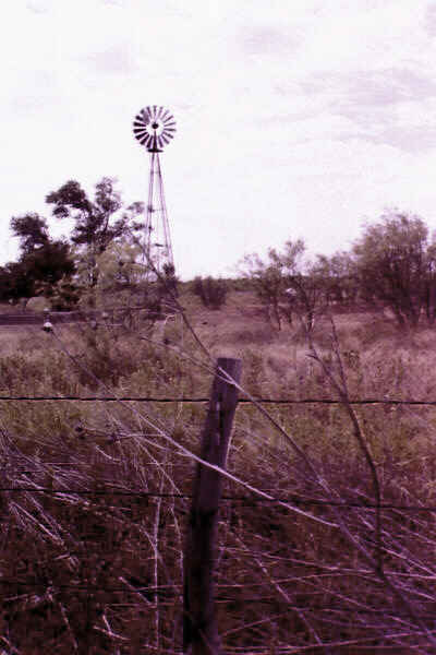
across the street (not the rail depot) housed farming implements and
the yard of the hotel/saloon had a windmill and various other
miscellaneous big things that could be stored outside. All in all, we
could have spent another 1-1/2 hours there if we'd had the time.
Also, the oiled floors, and the old building smell were starting to
give me a whopper of a sinus headache. This is definitely a museum
which has to be heavily supported by the community and needs to be
exposed more to the public. It shouldn't be missed. Brett referred to
it as the best collection of 19th century antiquities since the Smithsonian.
Balmorhea was a small oasis in the desert,
however, there was little to no interpretive signage. There was
mention of a spring which is now part of the swimming pool being the
water source for the bog and Brett deduced the rest. It was odd that
this state park had no explanations of the area or even a history of
the endangered species.
I-10 east to Sheffield, TX
TX-290 east to I-10
I-10 east to Junction, TX
US-377 south to Junction, TX
We left Fort Stockton without going to the
Fort, as it didn't open until 10 am and we didn't want to wait around
because we had some miles to cover to get to South Llano River State
Park. As we drove east, we noticed the trees getting more numerous
and taller, and the gravel-look of the landscape was giving way to
grasses and more vegetation. It was still a desert-like area, but not
the actual Chihuahua Desert, where we'd spent the last 48 hours.
Although the creeks and draws and river-beds were still dry, you got
the feeling from the landscape that the potential for water was there.
We stopped at Fort Lancaster State Park,
which was nothing more than the ruins of a US Army outpost
established in the mid-1800's to provide escort for travelers going
along the trail to El Paso & California from San Antonio and
points east. There was quite the Indian problem back then,
apparently. The Civil War broke out and the fort was abandoned.
The gentleman manning the park was a retired
rancher who was born and raised in the area. He told us all sorts of
stories he'd heard about the fort and also some of the interesting
facts about the area. They had a particularly interesting-looking
insect under glass there. It sort of resembled a large, large ant in
the body, but it had claws like a scorpion and a radio antenna for a
tail. [It was]
A curious-looking creature, which the docent said is common around
there and is featured in their book about scorpions. he said he was
told it was not poisonous, but I did notice that he used a pencil to
show us that it didn't attack.
We drove straight about 2 hours to Junction.
We set up camp and wandered off to the lake and the river for
fishing—Brett, and looking—me. This is really a pleasant
park; it reminds me of a more arid Mission
Tejas. There are extensive hike/bike trails in the Buck Wildlife
Management Area which is attached to this park. We saw a herd of deer
(about 6) munching away a little distance from the road when we drove
in. That was a good sign! Also, the water is crystal clear and seems
to change colors depending on how deep it is and what's on the
bottom. A lot of it looks shiny green, until you look closely and
realize that you're seeing the bottom.
The water was a refreshing as it looked.
Cool and clear and gurgling over the rocky bottom. I saw lots of deer
and lots of wild turkey and a kind of charcoal-grey squirrel who was
long and skinny.
US-377 north to Junction, TX
I-10 east to US-290
US-290 east to Johnson City, TX
TX-2766 east to Pedernales Falls SP, TX
TX-3232 south to Henley, TX
US-290 east to Austin, TX
US-183 south to Lockhart, TX
US-183 south to Luling, TX
I-10 east to Home
The park was even more pleasant in the
morning than it had been the night before. It had cooled off enough
that I needed a sheet over me to sleep. We packed up and got on the
road and caught I-10 to 290 in order to make a big loop around to
Fredericksburg, Austin, and down to our night's campground at
Lockhart State Park.
While in Fredericksburg, we went through the
Admiral Nimitz Historical Museum and Park. This was an extremely
interesting and busy museum dedicated to the life and career of
Admiral Chester W. Nimitz, which also involved the naval history of
the Pacific Theater of World War II. Nimitz struck me as someone I'd
have enjoyed knowing. He was portrayed as a down-to-earth Texan with
an easy-going, affable manner, who trusted the people he commanded to
do their jobs without him hanging around. He also seemed to have a
keen sense of timing and a great knowledge of military tactics. I
found it interesting that he predicted that the Viet-Nam War would
end in stalemate and that World War III was inevitable. There was, on
the grounds, a traditional Japanese garden which was dedicated to
peace, however, and had koi the size of our cat, Shadow. Wait, maybe
even bigger.
We left Fredericksburg for Perdenales Falls
State Park to have lunch. This park is up in the hills, filled with
juniper and smells so good. The water was way down, so the falls were
low, but it was more interesting to see where it usually is with the
mineral deposits and the brush debris left everywhere. The approach
down to the falls is built of local stone and has an overlook with
two levels, then stone stairs down either side. It would be neat to
come there when the water was high to see the difference.
The park map had all sorts of warning about
flash floods being common and, at one time, they even had a flood
siren that could be sounded to let everyone know to evacuate the
area. It was blacked out on the map and Brett asked why. The docent
said that they didn't have the siren anymore. I didn't quite
understand whether they didn't need it or whether it just wasn't used
any more.
It is a lovely park, but the most expensive
of the Texas Parks we visited. The day use fee was $4 per person and
the overnight fee was $16. We paid $12 at Llano and $10 and $7 at
other parks. Must be because it's so popular and so close to Austin
and San Antonio.
We wandered on straight through to Lockhart
State Park, deciding to leave McKinney Falls, just outside of Austin,
for another time. Since it was Friday night, we didn't want to run
the risk of the park not having space left when we got there.
Lockhart was like Harry McAdams State Park
in New Mexico in that it had a golf course and seemed to be a city or
county park first and only had camping because the State took it
over. Brett fished a little in the creek which ran parallel to the
campsites while I lounged and read.
The later it became, the more I expected it
to cool off like it had in other parks. We both took showers hoping
to cool off and prepare for a humid night of sleep. About 8pm, when
the weather showed no signs of cooling off, and Brett had found out
that someone he'd spoken to had run their air all the previous night
in order to be comfortable, we decided to come on back to Houston,
after all.
Saturday, we had planned on visiting
Palmetto State Park and then eating at Frank's in Schulenberg, but
they could be done another day. I felt so wary about staying the
night in Lockhart Park, and Brett agreed, that we thought it best to
head home and end the trip on a high note.
We were just unloading at about 11pm when
Sheila and Chris pulled up to feed and water the pets. The stayed for
a few minutes and bid us adieu and I flopped into bed and spent a
very cool night sleeping like a log.
This was a long and exhausting, but very
fun, trip. We discovered that West Texas is filled with a whole lot
of nothing, that the minimum population for a town to rate a Dairy
Queen is 2000 (except when the town is in a tourist area or in close
proximity to a larger town), and that the west side of the hills is
much more comfortable in the heat than the east side. I'll be anxious
to make our way out that direction again, but in the fall, when it's
a tad cooler. There's so much to experience out there and the people
are genuinely nice to talk to and have an understanding of what's
important in life.
Throughout the trip, we saw roadside burns and
even some burns on the hiking trails, and I was continually struck by
the horrible effects of the thoughtlessness of just a minority. These
burns were obviously caused by cigarette butts carelessly thrown
aside, and, while I am also a smoker, I try to make a point of not
throwing cigarettes out my window, especially in dry areas. One farm,
near Austin had lost the entire front yard and all of the greenery
around a cowpond to a roadside burn. Oh, well.